Tourist Places to Visit in Jispa, Lahaul and Spiti, Himachal Pradesh, India

Tourist Places to Visit in Jispa, Lahaul and Spiti, Himachal Pradesh, India

Jispa is a village situated in Lahaul and Spiti District of Himachal Pradesh in India. It is situated about 388 km from the state capital city Shimla and about 20 km north of district main town Keylong. Jispa is a tourist centre houses a folk museum and a beautiful valley.

Jispa is located between latitude 32°38′0″ in the north and longitude 77°10′0″ in the east and the town is positioned at an elevation of 3,200 meters. Jispa houses a helipad, a post office and a monastery. The forest near Jispa home to special species of animals like yaks, dzos, Tibetan antelope, argali, kiangs, musk deer, snow leopards, ibex, brown bears and foxes.


People, Lifestyle and Religion in Jispa:

The population of Jispa comprises of Tibetan and Indo-Aryan. The official language of Jispa is Hindi and also the natives speak other Indian and Tibetan languages. The houses in Jispa are built in the style of Tibetan architectural.

Agriculture is the main economy source of the locals of Jispa. Potato is the general crop grown in Jispa and also natives are involved in animal husbandry, government services and weaving business.

Trilokinath Temple is the major temple located near Jispa and also the locals celebrates The Losar festival with Tibetan fashion during the months of January and February every year.


Food and Shopping in Jispa:

The daily diet of Jispa are very similar to the rest of the regions of the state. Non-vegetarian cuisine is more preferred in Jispa and the natives use lentil, broth, rice, vegetables highly in their dishes. Madira, Pateer, Chouck and Bhagjery are some of the special dishes of Jispa.

Shopping near Jispa is a unique pleasure as the charming and romantic ambiance adds that extra zing to the shopping expedition. Tibetan handicraft items like antiques, Buddhist style curios, carpets, woolen shawls, rugs and Feng-Shui items can also be bought near Jispa.


How to reach Jispa?

Private vehicles like Taxis, Buses and Taxis provide transportation services to tourists to reach major tourist destination near Jispa Village. Manali Bus Stand is the main bus stand for its surrounding regions and also plenty of vehicles pass through Jispa and further towards major towns of the state.

Panch Rukhi Railway Station is the nearest railway station to Jispa located about 100 km. Other railway stations placed near Jispa are Baijnath Mandir Railway Station and Palampur Himachal Railway Station. Jispa is placed 190 km away from its nearest airport Bhuntar Airport.


Places to see near Jispa:


Chandra Taal:

Chandra Taal is located on the Samudra Tapu plateau at an elevation of 4,300 meters. It lies in 32.47518° N latitude and 77.61706° E longitude and positioned at an altitude of 4250 meters.

The name of Tall derives from its curved shape and is one of the favorite spots of trekkers and campers. Chandra Taal is located about 30 km from another popular tourist destination Suraj Tal.

Huge fields on the banks of the lake are the camping places. During springtime, these fields are carpeted with hundreds of varieties of wildflowers. The main amazing thing about this lake is that there is no noticeable basis of this lake but there is an observable opening of this lake which means that water to this lake comes from underground. May to early October is the great time to visit Chandra Taal.


Tabo Monastery:

Tabo Monastery is located in Tago Village of Spiti Valley of Himachal Pradesh. There are many precious groups of thankas, manuscripts, fine-preserved statues, frescos and widespread murals which wrap almost every wall of monastery.


Kardang Monastery:

Kardang Monastery is the most important monastery located on Lahaul Valley. It is positioned on the banks of River Bhaga at an elevation of 3,500 meters. The Monastery was constructed during the period of 12th century and has a bigger library of Buddhist literature.


Gandhola Monastery:

Gandhola Monastery also known as Guru Ghantal Gompa which placed on the Manali Road about 19 km from Keylong Town. It is believed that Guru Rinpoche was the founder of Gandhola Monastery. This monastery is popular for its eight storey fort with flashing layers of stone and wood.


Other tourist places near Jispa include:

  • Dhankar
  • Shashur
  • Kye Monastery


Ideal time to visit Jispa:

From January to March is the great time to reach Jispa due to the celebrations of The Fagli festival and The Losar festival.


Accommodation options near Jispa:

The major hotels situated in Jispa, Keylong and Manali are as follows:

  • Padma Lodge
  • Hotel Jispa
  • Hotel Ibex
  • The Chandrabhaga
  • Hotel Deykith
  • Highland Park
  • Apple Country Resorts – Manali
  • Honeymoon Inn
  • Hotel Manali Heights

Beautiful Tourist Places in Jhunjhunu, Rajasthan, India

Beautiful Tourist Places in Jhunjhunu, Rajasthan, India

Jhunjhunu is a town situated in Jhunjhunu District of Rajasthan in India. It is the administrative headquarter of Jhunjhunu District situated about 169 km away from the state capital city Jaipur and about 231 km from national capital Delhi. The town is widely known for its frescos style of painting.

Jhunjhunu District is surrounded by Sikar district in the south, Mahendragarh district of Haryana to the east, Churu district on the northwest and Bhiwani district in Haryana towards northeast.

Jhunjhunu is situated between 28.13° N latitude and 75.4° E longitude and Jhunjhunu District covers an area of 5,926 sq. km. The Postal Code of Jhunjhunu begins from 333001 and the town is placed at an altitude of 323 meters.

Khetri Town of the Jhunjhunu district is the largest copper mine producer in the country. Jhunjhunu is also famous for its tourist destinations, higher and technical education centres. Shri Radheshyam R Morarka Government Post Graduate College is the major educational institution of the town.


Etymology and History of Jhunjhunu:

Jhunjhunu gets its name from Rajput ruler Jhunjhar Singh G. Jhunjhunu and is highly witnessed for the rule of Chauhan Dynasty during the 13th century. It is said that Mohammed Khan & his son Samas khan conquer the lands of Jhunjhunu in the year 1450 by beating the Chauhan Kings.

Jhunjhunu was ruled by Nawab Kings for nearly 300 years. It is believed that Mohammed Khan and Rohilla Khan were the first and last Nawabs to rule Jhunjhunu in the past.


Culture, Food and Shopping in Jhunjhunu:

Jhunjhunu has a strong cultural background and famous for its Fresco, a technique of mural painting. During Amavasya thousands of native groups in this area take a holy bath. Jhunjhunu has number of memorials those integrated with the stories of soldiers and their lives.

Most of the Jhunjhunu people are vegetarians and they highly prefer Rotis, Chapatis of Wheat and Jowar. Also the town has several south Indian and North Indian Restaurants along with local food centres.

Jhunjhunu is one of the rapidly developing towns in Rajasthan state hosts numerous retail outlets, cotton centres, marriage halls, film theatres, vehicle showroom and handicraft shops.


How to reach Jhunjhunu?

Jhunjhunu has good connectivity with its nearby regions and major towns of the state through developed road network and railway transport. It is very easy to board buses in Jhunjhunu Town because town has plenty of bus stops all round.

Jhunjhunu Railway Station is the major Railway Station for its surrounding regions located 3 km away from the heart of the town. Jaipur Airport is the nearest airport to Jhunjhunu placed at distance of 182 km. Also there are ample number of private vehicles like Taxis, Auto and Buses available to reach airport and railway stations.


Places to see in Jhunjhunu:

Dargah Qamaruddin Shah:

Dargah Qamaruddin Shah is a place of Muslim sufi saint Hazarat Qamaruddin shah located in midpoint of the town on the foot of the Kana Pahar Hill. It includes Dargah, Mosque and other Islam memorials. The Dargah square gives a beautiful view of the town and there is cultural events held every February attracts thousands of followers from the surrounding districts.


Badalgarh Fort:

Badalgarh fort is one of the historical monuments of Jhunjhunu constructed by Nawab Fazl Khan during the period of 17th century. The fort has massive fortified walls with small windows.


Rani Sati Temple:

Rani Sati Temple is a famous temple devoted to feminine bravery Shri Rani Satiji. A holy ritual is held on the time of ‘Bhado Amavasya’ here. The major part of the temple was built with white marbles. The temple has different types of murals and colorful wall paintings. This temple is visited by regular devotees to offer rituals and appeals.


Khetri Mahal:

Khetri Mahal also known as Wind Palace was constructed by Bhopal Singh in 1770, the chieftain of Khetri. It is famous for its architectural heritage and the palace was made with marble. This palace is similar to Hawa Mahal of Jaipur.


Other tourist attractions in and around Jhunjhunu include:

  • The Modi and Tiberwala Haveli
  • Shekhawat Rajput’s Chhatris
  • Zorawargarh
  • Mertaniji ki Baori
  • Badalgarh Fort
  • Akhegarh Fort
  • Dhosi Hill
  • Jorawar Garh
  • Bihari Ji Temple
  • Laxmi Nath Temple
  • Samas Talab


Best time to visit Jhunjhunu:

The best time to visit to Jhunjhunu is between the months of November and February. The climate conditions during winter season is very pleasant.


Accommodation Options in Jhunjhunu:

The facilities provided by the hotels in Jhunjhunu are doctor on call, swimming pool, travel desk, car parking, laundry service, gymnasium, health club and conference hall. Prominent hotels in Jhunjhunu are as follows:

  • Narayan Niwas Castle
  • Hotel Roop Vilas Palace
  • Hotel Jamuna Resort
  • Singhasan Haveli
  • Hotel Mandawa Haveli
  • Hotel Heritage
  • Hotel Castle Mandawa
  • Hotel Tulip Inn
  • Udai Vilas Palace
  • The Piramal Haveli
  • Sara Vilas
  • Mahansar Fort
  • Alsisar Mahal

Best Tourist Places to Visit in Jhumri Telaiya, Koderma, Jharkhand, India

Best Tourist Places to Visit in Jhumri Telaiya, Koderma, Jharkhand, India

Jhumri Telaiya is a well known town as well as the famous tourist centre placed on Damodar Valley in Koderma District in Indian state of Jharkhand. Jhumri Telaiya is located between 24°25′48″ north latitude and 85°31′12″ east longitude and is positioned at a height of 383 meters from the ground level of sea.

Jhumri Telaiya is situated 8 km away from district main town Koderma and about 154 km from state capital city Ranchi. The Postal Code of Jhumri Telaiya is 825409.

Jhumri Telaiya is widely popular for its mica center and sponge iron plants. It is one of the corporate favor regions in Jharkhand State because of its easy access, good road-rail connectivity and good power infrastructure. Also Jhumri Telaiya is home to numerous nationalized banks, schools and colleges.


Etymology and History of Jhumri Telaiya:

There are several theories about the origin of the name Jhumri Telaiya. ‘Jhumri’ is the name of small village and ‘Telaiya’ is the name of Tilaiya Dam.

British were the first to invade mica mining resources in Jhumri Telaiya during the period of 19th century. Before merged with Koderma District on 10 April 1994, Jhumri Telaiya was a part of Hazaribagh district.


Food, Culture and Shopping in Jhumri Telaiya:

The people of Jhumri Telaiya are equal lovers of both vegetarian and non vegetarian food items. Pechki, Kathal, Saakhin, Sanai phool and Barri are the famous staple foods and Imli chatni, Phutkal achhar and Kathal ka achar are the popular pickle items in Jhumri Telaiya.

Jhumri Telaiya has several good numbers of cultural centers of music and dance and numerous cultural events are held in cultural centers every month. Also Jhumri Telaiya is famous for its temples and annual fairs organized in major temples of the town.

The shops in and around Jhumri Telaiya are widely popular for its handicrafts products and archeological items. Also several modern retail outlets have also started their operations in Jhumri Telaiya Town.


Connectivity to Jhumri Telaiya:

Buses, jeeps, and three-wheelers help people to reach nearby regions and major towns of the state. National highway 31 passes through Jhumri Telaiya connects it with main cities of the state and the country as well. Buses are easily accessible from Jhumri Telaiya Town Bus Stand and Koderma City Bus Stand.

The Koderma Railway Station is the nearest railway station to Jhumri Telaiya located at a distance of 1 km and there are train services available to Delhi, Kolkata, Mumbai, Ahmedabad, Indore, Bhopal, Lucknow and Bhubaneswar from Koderma railway station. The distance between Jhumri Telaiya and Ranchi Airport is about 160 kms.


Tourist places in Jhumri Telaiya:


Telaiya dam:

Telaiya Dam was the first dam built in Koderma District. The actual length of the dam is 1200 feet and the dam is placed at an elevation of 100 feet. Tilaiya dam is the major electric power station and has a capacity of 4 MW. Present day, the dam acts as a tourist destination by providing very good feel to tourists.


Sainik School Tilaiya:

Sainik School Tilaiya is an ancient educational institution and was established on 16th September, 1963. This school provides training for army groups and also it is well known for its extra-curricular activities.


Hazaribagh National Park:

Hazaribagh National Park is a major wildlife reserve in Jharkhand State home to tigers, panthers, sambhars, spotted deer, bisons and variety of birds. The park was established in the year 1976 and is situated about 43 km away from Jhumri Telaiya Town.


Sammed Shikhar:

Sammed Shikhar also known as Parasnath Hill is a popular hill station as well as a pilgrimage of Jain’s situated in Giridih district in Jharkhand State. It is placed at a height of 1,350 meters from the mean level of sea. This most sacred place of Jains is located 80 km away from the midpoint of Jhumri Telaiya Town.


Few other top attractions near Jhumri Telaiya include:

  • Rajgir
  • Sonbhandar Caves
  • Nalanda
  • Dhwajadhari Hill
  • Satagawan Petro falls
  • Har Har Dham
  • Makamaro Hills
  • Maa Chanchala Devi Shaktipeeth
  • Koderma Reserve Forest
  • Sant Paramhans Baba Tomb


Best time to visit Jhumri Telaiya:

The best time to visit Jhumri Telaiya is between September and May, the weather of the town is very pleasant during this period.


Accommodation options in Jhumri Telaiya:

Jhumri Telaiya hosts numerous good numbers of hotels and lodges. The hotels rooms are categorized into Standard, Deluxe, Executive and club of single and double occupancy. Major hotels situated in Jhumri Telaiya is as follows:

  • The Centre Square Hotel
  • Hotel Sunder
  • Bihar National Hotel
  • Sheetal Chaya
  • Tara Tawar
  • Xcellent Hotel
  • Krishna International Hotel
  • Sundar Hotel


Places to Visit in Jharsuguda, Odisha, India

Places to Visit in Jharsuguda, Odisha, India

It is one of the famous tourist destinations and the major commercial hub of Odisha State. Jharsuguda is popularly called as ‘the Power House of Odisha’ because of its larger presence of thermal power plants.

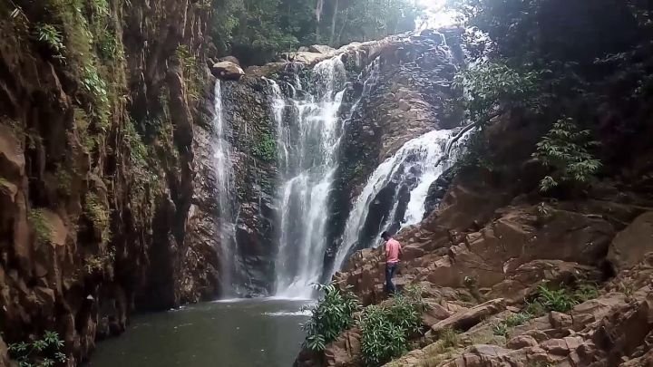
Gudguda Waterfall: Jharsuguda, Odisha

Jharsuguda is located between latitude 21.85° in the north and longitude 84.03° in the east. Jharsuguda District is surrounded by Raigarh district of Chhattisgarh in the west, Bargarh district to the south, Sambalpur district towards east and Sundargarh district in the north.

Jharsuguda District covers an area of 2,081 sq. km. and is positioned at an elevation of 218 meters. The Pin Code of Jharsuguda begins from 768201. Jharsuguda is located about 338 kms northwest of state capital city Bhubaneswar.

Jharsuguda is an upcoming industrial hub houses metal industry, cement factories, coal mines and has rich mineral resources. Ib River and Vheden River are the main rivers flowing through western and southern side of the Jharsuguda town respectively.

Culture of Jharsuguda:

Jharsuguda has always seen a very diverse population, especially since modern times. There are a lot of festivals & events hosted in Jharsuguda like Nuakhai, Rath Yatra, Durga Puja, Ganesh Puja and Bhai Jauntia.

Jharsuguda has a very strong art and culture scene, also a centre of renowned colleges, academic institutions, important central government establishments, scientific and research institutes and organizations.

Food and Shopping in Jharsuguda:

Jharsuguda has mixed food culture of both north and south Indian. Rice is used by majority of people also some people use wheat, maize and jowar as part of their routine diet. Buta Dali, Dalma, Mitha Bhata, Poda Pitha are the popular food items and Rasagolla is the famous sweet item of Jharsuguda.

Jharsuguda has plenty of modern shopping centres like malls, mobile showrooms and branded cloth stores. Along with modern shopping centres, Jharsuguda hosts numerous handcrafts shops, archeological item centres and home made things shops. Jharsuguda is jam packed with full of North Indian and South Indian Hotels and Restaurants.

Connectivity to Jharsuguda:

Jharsuguda is well connected by major cites of the state and the country through State Highway 10 and National Highway 200. Auto rickshaws, Savaris, Vans and Buses are the primary modes of transport vehicles operating services in Jharsuguda. Jharsuguda City Bus Stand is the major bus stand at Jharsuguda.

Jharsuguda Railway Station is falls under South Eastern Railway Division on Howrah-Nagpur-Mumbai line and Jharsuguda-Vizianagaram line and there are daily trains available to major cities of the country. The Jharsuguda Airport is under development and presently, nearest Airport to Jharsuguda is Ranchi Airport situated about 310 km away.

Places to see in Jharsuguda:

Gudguda Waterfall:

Gudguda Waterfall is one of the stunning tourist destinations sited in Sambalpur District. It is located about 40 km from the midpoint of the Jharsuguda City. Gudguda waterfall is covered by dense forest attracts tourists from all around the state for its natural beauty. The striking view of the intense forest and the waterfall provides relief to the tourists.

The water from the waterfall is used for irrigation that provides employment to the people of the locality. Tourists crowd to the place during the Christmas holidays and New Year. Especially in winter season from November to February visitors gather here to have some enjoy and eat out.

Kolabira Fort:

Kolabira Fort is a historical fort constructed with both Indian and western style of architecture showcases the quality of work of ancient architectures. It is located about 18 kms from the heart of Jharsuguda City. Kolabira Fort was built during the 18th century by the Chohan king of Sambalpur.

Shree Pahadeswar Temple:

Shree Pahadeswar Temple is placed east side of Jharsuguda Town at the peak of a small hill. It was built during the beginning of 20th century by Gujarati Contractor Lt. Bitthal Bhai Saha. It is well surrounded by Garden, Ashram and is one of the best sightseeing spots in Jharsuguda.

Koilighughar  Waterfall:

Koilighughar water fall is a famous holy waterfall and has Shivalingam called as ‘Maheswarnath’. It is located about 54 km away from Jharsuguda Town and here water falls from the height of 200 feet. The Shivalingam is not easily visible and is only visible during the winter and summer under the reflected light of Sun.

Other tourist attractions near Jharsuguda include:

  • Ruins of Hill Forts of Ulapgarh
  • Ramchandi Shaktipitha
  • Padmasini Temple
  • Jhadeswar Temple
  • Shiva Shrine of Mahadebpali
  • Chandi Temple
  • Laxmi Temple
  • Durga Temple
  • Hanuman Temple
  • Lalpathar

 Ideal time to visit Jharsuguda:

Best time to visit Jharsuguda is from November to February because of the important festivals and its tourist friendly weather.

 Accommodation options in and around Jharsuguda:

The famous Hotels in Jharsuguda are as follows:

  • The Orchard
  • Hotel Lalit Heritage
  • Hotel Meghdoot
  • Hotel Aryan
  • Yogendra Hotel
  • Hotel City Palace
  • Hotel Shankar
  • Hotel King Palace
  • Hotel Bishnu Palace
  • Hotel Ajanta
  • Konark Regency
  • Utkal Continental
scroll to top